Donate
Kakuma and Kalobeyei: Drone Imagery and Machine Learning for Better Planning of Refugee Settlements
Where do people go when they are forced to flee their homes? Many displaced people find refuge in cities and urban shelters, but that’s not always an option. Millions of other refugees live in refugee camps — temporary facilities built to respond to specific emergencies. As the need for refugee housing grows, planning for refugee settlements has become more complex.
To address this growing need, UNHCR, the UN Refugee Agency, is partnering with the tech sector to see if modern advances in artificial intelligence (AI) can be part of the solution.
To demonstrate how AI can address some of the most pressing issues in the humanitarian sector, Microsoft began a program in 2020 called AI for Humanitarian Action. The Hive, USA for UNHCR’s data science and innovation lab, supported this initiative by conducting research to better understand what kinds of high-impact problems could be addressed with AI. Solutions for refugee settlement planning was one of the ideas that emerged from the work.
The Hive’s research helped guide Microsoft’s investment strategy for its 2021 call for proposals which encouraged applicants to focus on the problems, not potential solutions; partner with stakeholders who would implement potential solutions; and ensure that underrepresented and affected persons were included in the project. UNHCR responded to the call and successfully received a grant from Microsoft by addressing the three criteria in the following ways:
- The Problem: Humanitarian groups recognize that accurate and up-to-date maps are indispensable tools for enhancing the quality of life for communities in crisis. However, clear, accurate maps and aerial imagery of refugee settlements have not been easily available. Without access to maps, UNHCR field operations struggle to make informed decisions, plan for resource allocation and provide an improved standard of living for the residents of the camps.
- The Implementing Agencies: In addition to UNHCR Kenya, several other implementing agencies, such as the Kenya Red Cross Society (KRCS) and the Kenyan government, responsible for sheltering refugees could benefit from accurate and up-to-date maps. Humanitarian OpenStreetMap (HOT), an international team dedicated to humanitarian action and community development through open mapping, was the perfect partner to ensure open access to such data and imagery.
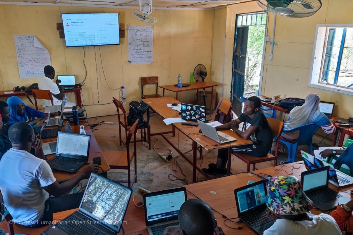
- Inclusion of Refugees: Throughout the development of the project idea and during implementation, refugees living in Kakuma refugee camp and Kalobeyei settlement in Kenya were involved in the process. One unique aspect of participation was that refugee residents were trained to use open mapping technology that would not only generate critical inputs for the models but would also help trainees gain a valuable skill for the future.
The Solution: Help UNHCR field operations plan more efficiently by leveraging advances in drone imagery to create open, accessible high-resolution maps used by AI models.
The ability to fly, store and use drone imagery was part of the innovative approach when compared to traditional satellite imagery. Over the course of the project, 102 drone flights, spanning 8.4K hectares, captured 161K images of data (near 3 terabytes). The images for Kakuma and Kalobeyei are available as part of HOT’s Open Aerial Map platform.
The higher resolution provides better data for AI models to achieve previously impossible levels of recognition of features on the ground such as tents, solar panels, latrines or even light poles. Mappers were trained to tag features in the images using open-source tool called the HOT Task Manager that creates clear ways for both refugees in the camp and volunteers from around the world to work together. Over the course of several weeks, everyone worked to identify features within the camps including those listed above and even animal shelters, waste disposal areas, and community gathering spaces.
Using AI for faster results: HOT’s trained mappers created the sample of features by manually tagging approximately 16 sq km over several weeks. Microsoft research scientists built 4 machine-learning models to automate the tagging the rest (an additional 66 sq km) of the camp not tagged by mappers.
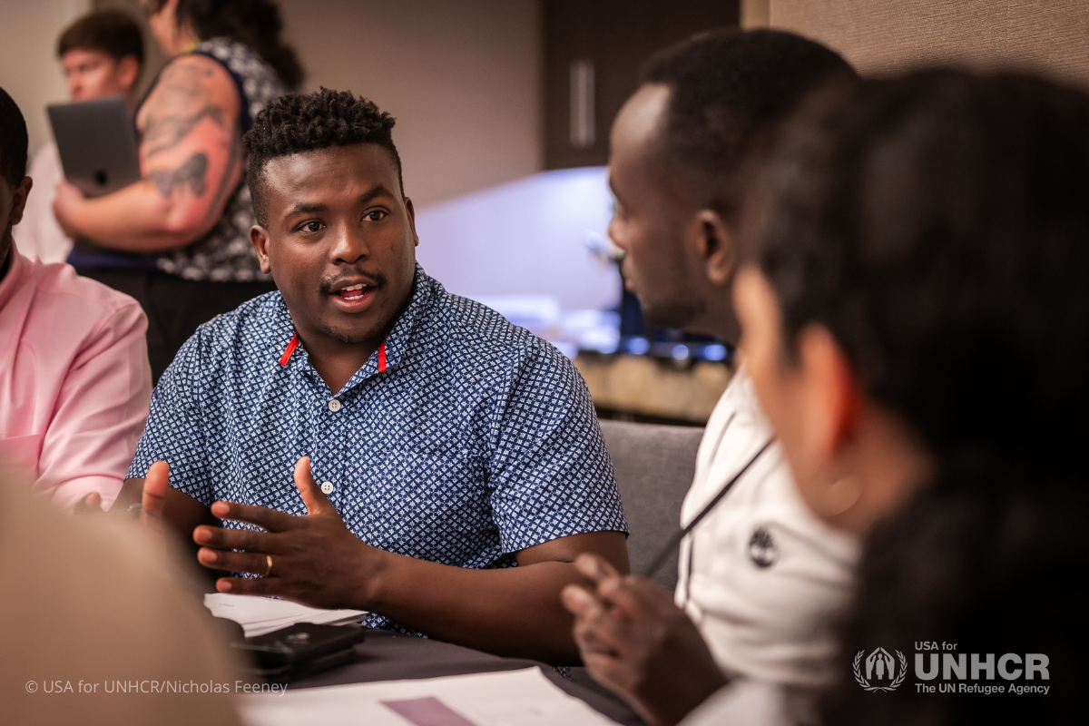
The maps and models are being used by the UNHCR Kenya operations team and implementing partners, including the Kenyan Government and organizations involved in sheltering refugees. The open-source code is available on GitHub for developers and civic technologists to use for similar purposes. Participants of The Hive’s annual forum #Innovate4Refugees during the UN General Assembly week in September 2024 will be shown ways to use these models and learn how AI can be used to assist in a humanitarian context.
Learn more about The Hive’s approach to engaging civic technologists using GitHub.
How you can help...
UNHCR, the UN Refugee Agency, supports the full journey of refugees who have been forced to flee violence, war and persecution. Our donors help refugees in their greatest time of need with shelter, food, water and medical care, and their support builds awareness for resettled refugees living in the U.S. With your help, more refugees will have the opportunity to build peaceful lives and give their families a bright future.
More Related News
Shelter and collective action take center stage at the year’s #Innovate4Refugees gathering
The Hive, USA for UNHCR’s data science innovation lab, convened its annual event, #Innovate4Refugees, to exchange ideas on open technology innovations for sustainable settlements and housing for refugees.
Hive Advisory Board member breaks down how technology is helping deliver results for refugees
Gotam Bhardwaj is a member of USA for UNHCR’s Hive Advisory Board (HAB) and the Co-Founder of Pairity. Hear from Gotam about the role technology plays in delivering solutions for refugees and how HAB is playing an essential role.